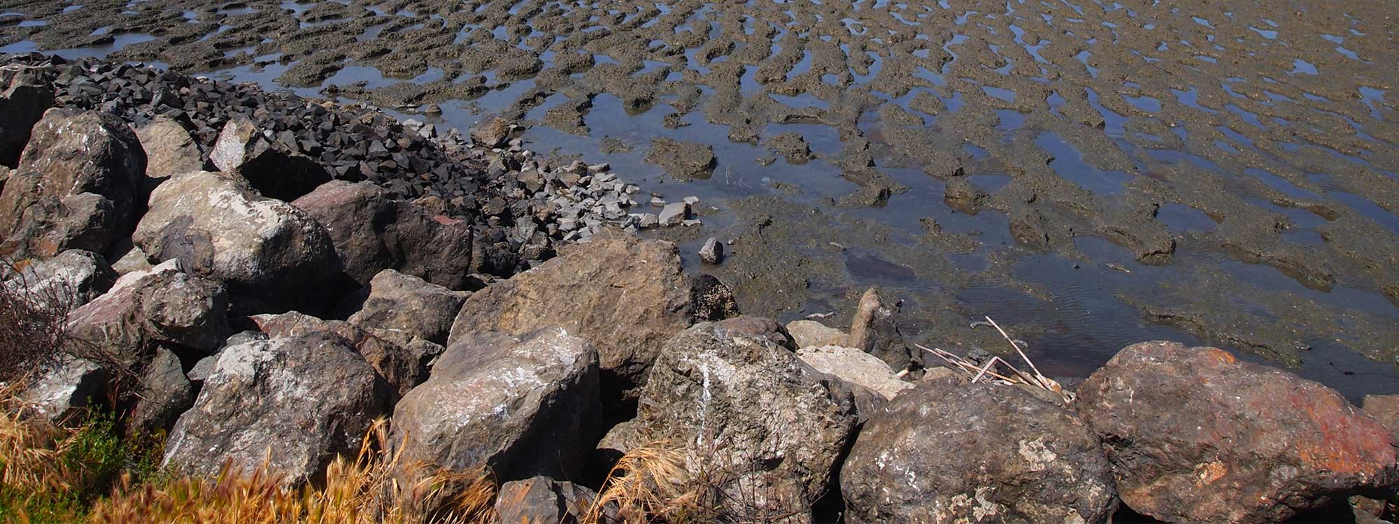

Just minutes from the frenzy of Hayward’s Southland Mall, you’ll find serene Cogswell Marsh, a 250-acre restored tidal saltwater marsh that is part of the Hayward Regional Shoreline. The levees along the shoreline were originally built for salt harvesting, but they were breached in the 1980s, and tidal flow returned to the land.
With tidal rhythms restored, the area quickly became a saltwater marsh filled with myriad birds and plants. Today, Hayward Regional Shoreline is managed by the East Bay Regional Park District and is a perfect place for hiking and biking.
The Cogswell Marsh loop hike – from the trailhead and back – is 2.75 miles. If you continue on to the Interpretive Center, the total distance is about 5 miles. Make sure to bring drinking water and a hat as there is no shade. However, a breeze wafting up from the bay will make the walk comfortable even in summer. If you are a birdwatcher, binoculars are a must as the shorebird activity is unsurpassed.
Cogswell Marsh Loop
From the parking lot at the end of West Winton Avenue, walk over to the information sign where you can pick up a brochure with a map. Then start out along the trail, following the sign for Cogswell Marsh. A large landfill area will be to your right. Airplanes occasionally fly overhead while ground squirrels dart below.
After an open stretch, you cross a footbridge and come to the head of the marsh. Because the trail is a loop, you can continue either way around the marsh, but try going to the left: To the east you can see Mount Diablo and Mission Peak. The marsh itself is covered with pickleweed with occasional orange splashes of the parasite dodder. Read the information panels that explain the marsh’s history and restoration.
As you round the bottom of the marsh, continue past Johnson’s Landing across another footbridge and up the west side. (If you want a longer walk, continue straight, a little more than a mile along the San Francisco Bay Trail to the Interpretive Center.)
In the mudflats, enjoy a spectacular collection of shorebirds – curlews with their gigantic decurved beaks, brightly colored avocets, marbled godwit, black-necked stilts, sanderlings and sandpipers. If you’re observant – and lucky – you can catch an egret or heron spearing a fish. To the west, across the bay, is Sutro Tower and the San Francisco skyline. When you complete the loop, head back along the trail to your starting point.
Interpretive Center
The walk to the Interpretive Center continues inland along the San Francisco Bay Trail. As you walk along the slough and wetlands, you come closer to civilization replete with the sights and sounds of traffic from Highway 92.
The Interpretive Center is perched on stilts above a marsh. Open weekends, it offers exhibits, activities and classes. You will find aquariums, microscopes, videos, a gift shop and a restroom. Naturalists present interpretive programs and lead walks. Even when the center is closed, you can climb to the observation platform and look at the surrounding salt ponds, which are habitat for the endangered western snowy plover. Notice the swallows swarming on the center’s roof.
Good to know
There are no dogs allowed south of the West Winton flood control channel, which is the part of the shoreline we are visiting. However, on-leash dogs are permitted from the flood-control channel north to the Grant Avenue parking area. There are only pit toilets, except for the restrooms in the Interpretive Center, which is open 10 a.m. to 5 p.m. Saturdays and Sundays. There are benches along the trail but no picnic tables, and shade is hard to come by.
Getting there
By public transportation: Take BART and exit at the Hayward or South Hayward stations. Catch the AC Transit No. 86 bus to West Winton Avenue and Cabot Boulevard. Walk west along Winston Avenue, about three-quarters of a mile, to the trailhead.
By car from San Francisco: Cross the Bay Bridge and take Interstate 880 south to Winton Avenue. Follow the signs to West Winton and continue on West Winton until it ends at the staging area.
Photo: Caligula1995 via Flickr