
In a disappointing vote March 20, councilmembers approved rezoning 43 acres of open space in South San Jose to make room for another lifestyle retail center. A different configuration could make Almaden Ranch more of a destination. One idea being promoted by neighborhood leaders — a pedestrian bridge over the Guadalupe River — could improve this project. Since last summer, the developer has made some improvements to the plan, such as a “village green,” and Greenbelt Alliance continues to urge special treatment of the Guadalupe River.
While this site was never designated as an urban village in Envision 2040, there is no escaping San Jose’s ambitious targets for increasing the number of trips people make on foot, by bike and by transit. Kudos to Councilmember Rocha for pointing this out in his memo to Council that, “if the city is truly committed to achieving (its goals), it needs to start prioritizing pedestrian improvements.”
Councilmember Kansen Chu was the lone vote against the project while Councilwomen Rose Herrera, Nancy Pyle and Madison Nguyen were absent.
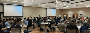
The Erikson Neighborhood Association did an excellent job of presenting their case as a “bridge to 2040” and illustrating the improved connections to light rail and homes to the east with a pedestrian bridge. “Liberate us from our cars” was a declaration they made.
While it is unfortunate to lose these 43 acres to regional commercial, Greenbelt Alliance is excited to explore the complexities and opportunities around revitalizing another San Jose urban corridor into a healthy, complete and walkable community — West San Carlos South Bascom. To learn more about it, please contact Michele.