
More than 4 million tons of coal (black diamonds) was extracted from the East Contra Costa foothills between the 1850s to the early 1900s. Workers from around the world, some as young as 8, arrived to labor in miles of underground mines. The mining towns of Nortonville, Somersville, Stewartville, West Hartley and Judsonville became booming population centers.
Later, from the 1920s to the 1940s, the Hazel-Atlas Glass Co. in Oakland and the Columbia Steel Works in Pittsburg took more than 1.8 million tons of sand from the area.
Today, the land is managed by the East Bay Regional Park District. There are more than 60 miles of well-marked trails on the 6,000-plus acres. The cattle you see grazing in the preserve are owned by descendants of the original mining families.
A 90-minute guided tour of the Hazel-Atlas Mine is offered at noon and 3 p.m. on weekends from March through November. Walkers will take a 950-foot stroll into the sand mine to see ore chutes, mine workings, the mine boss’ office and geological features. Tickets for the tour, costing $5 per person, can be purchased at the Greathouse Visitor Center; the minimum age is 7. Or call (888) 327-2757, option 2 to get the schedule and make a reservation.
Those used to chilly coastal fog may be surprised at how hot East Contra Costa can be, so bring a hat and water. (If you are taking a tour, bring a sweater, as the mine interior is cold.) Go on your own or join the Greenbelt Outing on Sunday. (Note: You must be a Greenbelt Alliance member to take Sunday’s Black Diamond tour. Memberships start at $25 and can be purchased at bit.ly/PB1fQm; or you can purchase a membership at the outing for $25.)
Greathouse Visitor Center
Walk uphill from the second parking lot and follow the signs to the recently reopened Greathouse Visitor Center. On your left are hills of dark sand, tailings from the sand mining operations. (Light sand was preferred for glassmaking.)
Open weekends and some holidays March through November, the visitor center is an underground chamber, the original opening into the sand mine. Inside the chamber, pick up a brochure with a trail map. Explore the workings of the sand mine and view photographs, videos and artifacts showing the lives of the coal and sand miners who once worked at Black Diamond. At the far end, you can peer deep into the mine.
Chaparral Loop Trail
When you leave the visitor center, walk up the wooden steps to the Eureka Slope, an inclined shaft that was the entrance to the Eureka Coal Mine. At the green water tower, pick up the Chaparral Loop Trail. (Note: This takes you counterclockwise around the loop. If you’re not stopping at the Visitor Center, you can pick up the trail earlier and go around the other way.)
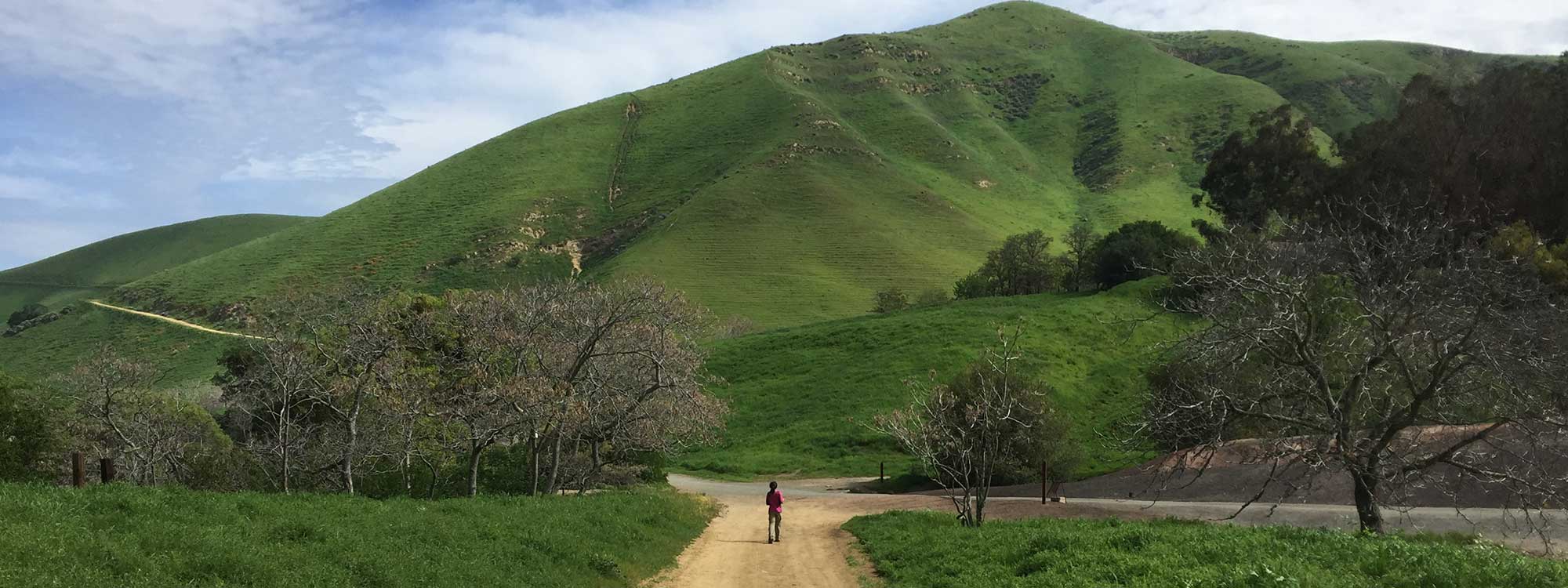
This 2-mile walk has a little bit of everything – woods, open country, exposed rock faces and mining sites. You pass through manzanita groves, toyon, buckeye and Coulter pine. There are also nonnatives – eucalyptus and the Chinese tree of heaven – and plenty of wildflowers. Depending on when you go, you may see Indian paintbrush, sticky monkeyflower, California poppies, lupine, mule ears, yarrow and buttercups. A side-blotched lizard might skitter across your path.
The trail passes the stope, a huge chamber blasted out of sandstone for rock used in glassmaking, and the powder magazine, a small excavation used to store explosives. The Hazel Atlas Portal, near the end of the loop trail, is the entrance to the sand mine.
Rose Hill Cemetery
A must side trip is a stop at Rose Hill Cemetery, a picturesque 1860s hilltop burial ground that served the five coal mining towns. Pick up the Nortonville Trail at the parking lot. Although the cemetery is less than half a mile from the parking lot, the road is unshaded and uphill, so be prepared.
Below the rough headstones are graves of children who died of scarlet fever and typhoid, young men who perished in mining accidents and mothers who died in childbirth. Those who were buried at a comfortable old age were the exceptions.
Wander among the headstones in the tall grasses, looking out at the undulating hills beyond. Only 80 gravestones remain, as the cemetery was extensively vandalized. Today, the park district is restoring and preserving the cemetery with repaired gravestones and rebuilt brick and wrought iron enclosures. A list of known burials is posted as you enter, showing the location of each plot.
Getting there
Take Highway 4 and exit at Somersville Road in Antioch. Drive south (toward the hills) on Somersville Road to the park entrance. Parking fee is $5 when kiosk is attended. Continue to the second parking lot.
An alternate route is to take Highway 24 to the Interstate 680 interchange. Head north on I-680 and exit at Ygnacio Valley Road. Head east on Ygnacio for nearly 8 miles, when it turns into Kirker Pass Road and go another 5 miles. Turn right on Buchanan Road and continue for about 3 miles to Somersville Road. Turn right on Somersville and continue into the park.
Photo: Ray Bouknight via Flickr