
The Association of Bay Area Governments and Metropolitan Transportation Commission are hosting public workshops in all nine Bay Area counties to gather input for their just-released scenarios on how to update Plan Bay Area.
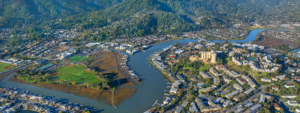
Plan Bay Area, adopted in 2013, was designed to lay out a vision for how the Bay Area should grow. For the update, MTC and ABAG have developed and evaluated three land use and transportation scenarios.
The three scenarios describe different alternatives for how expected growth in population, jobs and housing units might be distributed, and the types of transportation investments needed to support these growth patterns. While the scenarios vary in terms of the intensity of development patterns and transportation investments, they maintain the same regional forecasts for jobs, population, households and transportation revenues.
ABAG forecasts an additional 1.3 million jobs, 2.4 million people and therefore the need for approximately 820,000 housing units between 2010 and 2040.
Elements from the three scenarios will be combined into a single “preferred scenario” that will form the blueprint for the updated Plan Bay Area.
The Alameda County open house will be held from 6:30 to 8:30 p.m. on Thurs., June 2 at the MetroCenter Auditorium, 101 Eighth Street, Oakland.
Scenario 1, labeled Main Streets, targets future population and employment growth in the downtowns of every city in the Bay Area. A number of the region’s cities would experience significant growth and different types of development compared to existing patterns. Within cities, more growth will be accommodated outside of preferred development areas (PDA). It comes closest to resembling a traditional suburban pattern, with an increase in greenfield development to accommodate the dispersed growth pattern. This scenario assumes that many people will drive significant distances by automobile to get to work.
To support this dispersed growth pattern, transportation investment priorities will emphasize highway strategies, including the expansion of high-occupancy toll lanes on all regional highways, the institution of variable pricing, and highway widening at key bottlenecks.
Scenario 2, identified as Connected Neighborhoods, targets future population and employment growth to locally-identified PDAs along major corridors, with an emphasis on growth in medium-sized cities with access to the region’s major rail services, such as BART and Caltrain. Outside the PDAs, this scenario sees modest infill development. All new growth would be accommodated within existing urban growth boundaries or urban limit lines.
To support this scenario’s growth pattern, transportation investments will prioritize maintenance of existing infrastructure. The region’s transit system will be modernized and expanded along key corridors to improve commutes and add capacity.
Scenario 3, Big Cities, assumes that most of the region’s population and employment growth will be located in San Francisco, San Jose, and Oakland—with the remainder primarily in cities directly proximate to the three biggest cities and areas well served by transit. The amount of growth outside these areas is minimal, with limited infill development in PDAs and no greenfield development.
The transportation infrastructure within and directly serving the region’s core will be maintained to a state of good repair, modernized to boost service and improve commutes and capacity, and expanded to meet increased demand.
Greenbelt Alliance in reviewing the options, wrote, “Scenario 1 would develop 565 square miles of natural and agricultural lands outside those UGBs—paving over an area 11 times the size of San Francisco. .”
According to Greenbelt, The scenarios don’t include enough options to make it easier to walk, bike, and take transit.”
Comments on the three scenarios can be submitted online at planbayarea.org.
This article was originally published by The Independent.