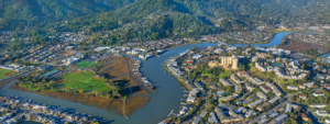

On the southern shore of Alameda is Crown Memorial State Beach, whose long shoreline looks across the bay to San Francisco and San Bruno Mountain. At the western end is horseshoe-shaped Crab Cove, a perfect spot for exploring tide pools and watching shorebirds. From there, you can walk 2.5 miles along the Shoreline Trail to the Elsie Roemer Bird Sanctuary, a salt marsh at the eastern end. Long a popular Bay Area destination for its inviting water and warm sands, this beach has been the setting for amusement parks, carnivals, balloon rides and prize fights. The park is named after its champion, state Assemblyman Robert W. Crown.
Crab Cove
Start your outing at the Crab Cove Visitor Center (1252 McKay Ave.). This warm and friendly wooden building, often filled with schoolchildren, offers an 800-gallon aquarium filled with marine creatures, hands-on exhibits and a well-stocked bookstore.
Walk down to the Crab Cove Marine Reserve. During low tide, a special wheelchair-accessible ramp and viewing path leads you right down to the water, where you can almost touch the barnacles. This is a protected area; collecting or disturbing marine life is not allowed.
Depending upon the tide and the season, you may see brown pelicans, grebes, mallards, buffleheads and shorebirds such as sandpipers, dowitchers, willets and egrets.
Crown Beach
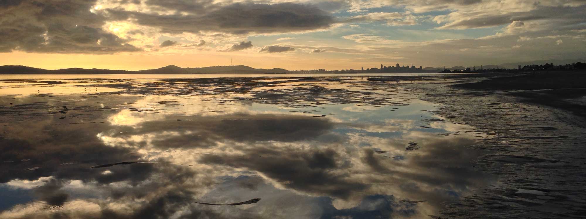
As you walk east along the shore (water on your right) to start along the Shoreline Trail, you enter an area filled with picnic benches, barbecue pits and freshwater lagoons. Canada geese and ground squirrels are everywhere. The main entrance to the beach (off Otis Drive and Eighth Street) offers wheelchair-accessible changing rooms and restrooms. Enjoy the views of San Francisco across the bay, especially from the City View picnic area.
Continuing on, Shoreline Trail may look like an ordinary sidewalk, but it’s a multiuse path: You’ll see cyclists too. To your left, across Shoreline Drive, are homes and apartments; to your right are dunes covered with native plants, such as California poppies and salvia, as well as the invasive ice plant, wild radish and dandelion. Frequent boardwalks lead across the dunes to the sandy beach: You can choose between the paved trail and the sand.
Getting hungry?
Past Willow Street on your left is South Shore Shopping Center, where you can stock up on lunch supplies for a picnic or stop for a bite at a cafe.
Elsie Roemer Bird Sanctuary
At Park Street, the beach ends as you come to the Elsie Roemer Bird Sanctuary, a marsh area that is home to many birds, including the endangered California clapper rail. Shortly before Broadway, a wheelchair-accessible overlook lets you gaze across the marshes. If you brought a picnic, this is a great spot for it.
The bright dense cordgrass that you see (Spartina alterniflora) is a fiercely invasive species that is marching through salt marshes around much of San Francisco Bay. A major eradication effort is currently under way. Past Broadway, the trail ends, but you can continue your walk on the mostly dirt path that continues along the marshland all the way to the Bay Farm Island Bridge.
Things to Know
The Crab Cove Visitor Center is open 10 a.m. to 5 p.m. Wednesday through Sunday. The parking fee in the Crab Cove lot is $5 from Memorial Day to Labor Day. Dogs on leash are permitted on the grassy areas and on the Shoreline Trail but not on the beach.
Fishing from the shore is permitted. Persons 16 and older must have a California state fishing license.
Getting There
By BART and bus, take BART to Oakland City Center/12th Street Station. From there take the 51 bus southbound to Santa Clara Avenue and Webster Street. Walk south on Webster two blocks to Central and then one block west to McKay. Turn left into the Crab Cove Visitor Center. By car, from San Francisco, go over the Bay Bridge and take Interstate 580 East to I-980 (downtown Oakland). Exit I-980 at 11th/12th Street. Continue several blocks to Fifth Street and turn left, staying in the left lanes. Follow the signs for Alameda and go through the Webster Tube. Continue on Webster Street until it ends. Turn right at Central, go one block, turn left on McKay Avenue. The Visitor Center is on the left.
Photo: Albedo20 via Flickr