An interview with expert Van Butsic of UC Berkeley
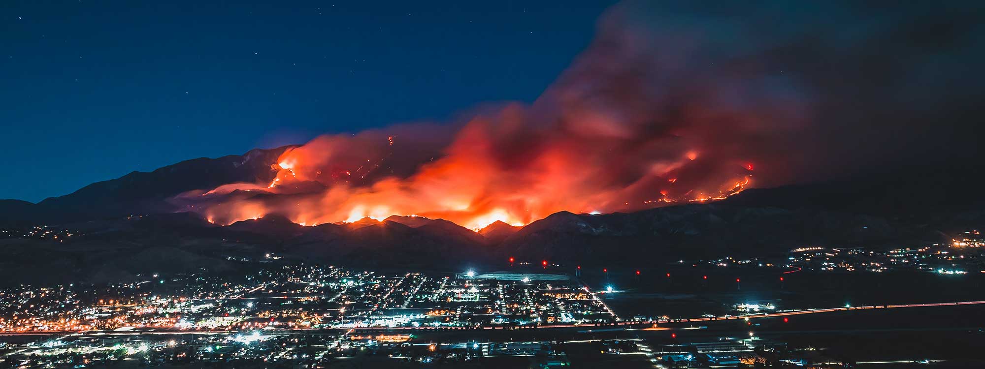
The devastating, record-level wildfires that have scorched more than 3 million acres across California serve as a stark wake-up call for residents of the Golden State to learn to coexist with fire. These blazes and the resulting social, ecological, and economic damages are on track to intensify with climate change. California is the state with the most people (11.2 million) currently living in the wildland-urban interface (WUI)—the area where houses and wildland vegetation meet or intermingle, and where wildfire problems are most pronounced.
While groups like Greenbelt Alliance work on the longer-term planning strategies to completely avoid building in the WUI in the first place, there are smarter design choices and planning decisions that can protect homes and lives from wildfire in the WUI to be applied right now as communities in the wildland-urban interface continue to grow.
Where and how we choose to build new developments are key to keeping Californians safe.
With the recent wildfires raging around us, the time to determine the best way to keep our communities out of harm’s way is now. So I sat down with Van Butsic, Land-Use Specialist at UC Berkeley, to discuss his latest research on the critical land-use decisions that can make communities less vulnerable to the inevitable wildfires of today and tomorrow. Through a series of questions and answers, this is what Van had to say.
Q&A
Q: What is your latest research on the topic of land-use and wildfire, and who do you hope will apply these findings in the real world as we grapple with how to live with fire?
There are various scales of decision making in having communities live with wildfire. Here in California, we talk a lot about what individual homeowners can do. This is usually guided by things like building codes, the way construction is done and the materials used. We actually see that rebuilt homes (or retrofitted homes) are safer than older structures because of these requirements.
Decisions at the next scale include determining where to build a new community or subdivision, what landscape is chosen to physically place this community, and how to arrange the new structures. These are the questions my latest research is trying to answer so communities are intentionally built to be more fire safe.
We all know that California is facing a housing crisis due to the lack of affordable residential units. This research is directed at thinking about how can California provide more housing––sometimes on landscapes with elevated fire hazard––while also reducing overall risk to wildfire. The goal is to encourage smarter design and construction that allow coexistence with inevitable wildfires.
There is not a lot of guidance out there on landscape-scale decision making. So, from this body of work, we are providing broad concepts to someone engaged in the local development process. The Board of Supervisors, city planners and other professionals working for development, really anyone who wants to be engaged in the development planning process could apply these concepts to inform how we coexist with fire.
“We should take advantage of these natural landscape features that can act as lasting buffers against oncoming wildfires.”
Q: What are the main take-aways? What should communities do to reduce their risk of wildfire?
There is evidence throughout California that density is one of the best ways to stop wildfires. We really should prioritize infill and redevelopment of existing urban areas. In the case of existing communities, say in the suburbs, there are ways to add density and simultaneously make them safer and more livable.
In planning for where new development occurs on or near flammable landscapes, we should again lead with density. Cluster communities, with the homes nearer to each other. Place these clusters near water bodies, large irrigated parks, swaths of agricultural lands. These types of natural spaces provide protection against wildfire. We should take advantage of these natural landscape features that can act as lasting buffers against oncoming wildfires.
These design principles fit well with policies to maintain agricultural land and natural land as well. There is pretty good evidence that irrigated agriculture in a fire zone, relative to non-managed lands, does a lot to reduce fire risk. We are starting to see evidence that even grazing makes a difference in reducing the likelihood of fire. So, not only having open space and letting it grow, but having actively managed open space encouraging fuel reduction, these are nature-based tools to bolster resilience to wildfire.
Q: There are graphics in the paper that compare placement of homes: one is a diffused approach and the other a more clustered approach (see below). Walk us through what the resilience practices are that you would prioritize in land-use planning to reduce risk and build resilience to wildfire?
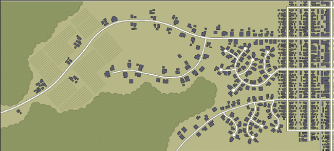
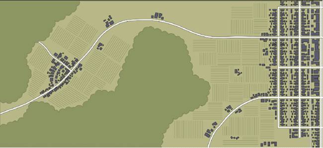
While it’s important to be site-specific and plan for the unique conditions of a new development, a really good general practice is development that creates less edge. What that means is that we can provide the same total amount of housing in a much safer way if designed to create less edge areas that need to be defended from fire.
Homes built in a clustered pattern are also easier to defend from fire, they require fewer fire resources to fight a fire, and there are additional benefits to this clustered approach beyond fostering wildfire resilience. Communities built with density reduce the distances of driving, reducing transportation costs and associated pollution from tail pipes. Similarly with water supply, the costs associated with the infrastructure to supply homes with water decreases the closer and denser the homes are to one another. All around, these concepts of density are climate-smart and promote resilience to the impacts of climate change.
“Communities built with density reduce the distances of driving, reducing transportation costs and associated pollution from tail pipes.”
Q: What surprised you while conducting this research?
To inform this work, my colleague Max Moritz and I sat down with community planners, fire fighters. We hosted numerous workshops to speak to a large number of fire professionals to talk about how the planning process works and where it is broken.
Typically, wildfire safety is not a high priority issue in development plans, even in California, sad to say. Yes there is a focus on evacuation routes, but that is not usually where plans are held up. What came out of our conversations about new development planning is that fire professionals really should be engaged much earlier in the process. Right now, projects get approval from the fire chief really late after the development is all ready to go. We really should engage them early on to avoid bad design decisions that put people in harm’s way.
Q: Did this body of work take into account the projected future size, scale, and scope of wildfires in California under changing climate conditions?
That’s a great question. A couple design elements we talk about in the paper do take into account the high likelihood that we will see some uncontrollable fires in the future. One thing we do call for is making sure there are public facilities and local refuges. This is because already in recent fires––especially the 2017 Tubbs Fire and the 2018 Camp Fire––we have seen that some fraction of the population will inevitably not evacuate in time and may be killed as a result.
So, constructing or retrofitting key structures to provide temporary refuge during a wildfire as places people can go in the worst case scenario is something we encourage. Maybe it’s a school that people in the community know exactly where it is or a hospital, but some location communities design and designate within the area as a sanctuary of last resort as we continue to be overwhelmed by how unpredictable and catastrophic wildfires are and likely will be into the future.
Q: The paper is very readable, digestible, and practical. If there is one additional point you want people to know, what would it be?
There are really minor things communities can do right now that would really make a difference to reduce people’s risk of wildfire.
A subdivision placing its new golf course outside the boundaries of the community, not inside (again to create that kind of open space landscape buffer between the fire prone area and homes). Dig the exterior road leading into the neighborhood up against a natural area, so all the homes remain inside and the road creates a fire break between homes and natural vegetation.
These changes are small, they are not huge changes to make when designing a new development. While not radical, these are the bare minimum things that are attainable to do in the development design and planning process that we really must do to continue to coexist with fire.
To read the full 30-page report, Building to Coexist with Fire: Community Risk Reduction Measures for New Development in California, download a copy for free here.
Van Butsic is an Associate Cooperative Extension Specialist and Adjunct Professor at UC Berkeley in the Department of Environmental Science Policy and Management where he conducts research on land system science, fire and forest policy, land use planning, and cannabis. He holds a PhD in Forestry and MS in Agricultural and Applied Economics both from the University of Wisconsin – Madison, and a BA in economics from Reed College.
Photo: Levan Badzgaradze via Unsplash