
In 2018, Greenbelt Alliance played a critical role in the Resilient By Design | Bay Area Challenge. Resilient by Design was a year-long collaborative design challenge that brought together local residents, public officials, and local, national, and international experts to develop innovative community-based solutions in order to strengthen our region’s resilience to sea level rise, severe storms, flooding, and earthquakes.
One of the projects that Greenbelt Alliance was instrumental in leading, The Grand Bayway (State Route 37) in the San Pablo Baylands received an SB1 Adaptation Planning Grant from the California Department of Transportation (Caltrans), with matching funds from the Metropolitan Transportation Commission (MTC). The project examines a full range of appropriate public access opportunities within an area envisioned as an “Ecological Central Park”.
After two years of hard work, Team Common Ground (TLS Landscape Architecture, Atlas Lab, Alta Planning and Design, Civicknit, Exploratorium, and Rana Creek Design) released a Public Access Scoping Report. The report explores the role SR37 plays as a vital east-west connection for communities not currently served by public transportation, crossing the four counties of Solano, Napa, Sonoma, and Marin, in an area made up of sensitive habitats, restored marsh and wetland complexes. The Baylands are a unique and special environment that is largely unknown to Bay Area residents and visitors and increasingly vulnerable to flooding and sea level rise.
The SR37 Public Access Scoping Report identifies the current state of public access within the San Pablo Baylands, including facilities for trails, developed park and open space, hunting, and water recreation, and recommends alternatives that could lead to a comprehensive, interconnected and resilient system over time. The report is intended to provide specific scoping direction for ongoing SR37 Planning Efforts and the objective of the report is to identify opportunities and constraints for land and water-based trails and recreation.
As the report details, conservation, connectivity, and coordination are key tenets towards a more resilient San Pablo Baylands. A resilient approach involves coordination of investments in light of sea level rise. Inextricably linked to this infrastructure are sensitive, yet productive, wetlands that serve as a major public amenity and ecological asset that can help buffer SLR and storm surge impacts.
Sea Level Rise in the San Pablo Baylands
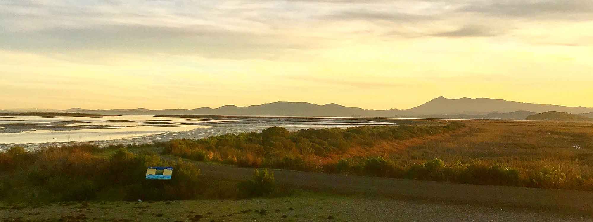
The San Pablo Baylands are an important part of the San Francisco Estuary, one of the largest on the West Coast of North America. Their unique physical and biological condition results from the Baylands location where the saline Pacific waters mix with fresh water from the Sacramento and San Joaquin rivers and four local watersheds that drain through the vast alluvial delta formed by them. Their ecological significance was amplified in 2013 when the estuary, including the Baylands, was added to the Ramsar List of Wetlands of International Importance. The list represents the keystone responsibility of the treaty signed in 1970 as part of the Ramsar Convention, which commits nations around the globe to develop and maintain an international network of wetlands that conserve global biological diversity and sustain human life.
The San Pablo Baylands are already impacted by both flooding due to incremental sea level rise, and occasional dike failure. These baylands present both a significant opportunity for ecosystem protection and enhancement as well as one of the biggest opportunities for natural-systems based resilient solutions for the San Francisco Bay. The richness of its biodiversity, and dynamic systems would be a loss to Bay Area residents who place great value on the beautiful natural places that make the region so special. Bay Area communities would benefit from better functionality from regional transportation, including SR37, Sonoma Marin Area Rail Transportation agency (SMART), the Bay Trail, and the Water Trail, with which proper coordination could create public access that also maintains protection of the Baylands’ sensitive ecosystems.
While various factors will play a role in the level of inundation—weather conditions, sedimentation rates, space for the marsh to migrate, among other factors—in the absence of action, this large scale marsh, one of the last of its kind, will be inundated by sea level rise. In the face of sea level rise, transportation infrastructure and Baylands restoration need to be in full coordination. Improvements for SR37 will be a transformative investment into this part of the bay and it can be leveraged for larger, more holistic solutions—if we can sufficiently raise the stakes and motivate broader interest.
The highway was originally a convenient cart road along a wave-created berm. Normally one would not hope to see a highway on such a shifting and transitory landform, but the highway is not going away. Like all sea level rise initiatives, canceling a negative is not an adequate story to generate interest from policy makers and funding sources. We need a narrative that converts the problem into a great transformation that benefits access, communities, and the Bay’s ecology.
Public Access Goals
Throughout the Resilient by Design project, our team heard strong interest in establishing and improving public access along SR37 and the San Pablo Baylands subregion. There is great value in also supporting public awareness through access—both water trails and built trails. Inviting the public to discover and appreciate the Bay’s natural resources can not only aid active transportation goals but also increase public support for habitat restoration funding. Many areas have great existing access that can be enhanced by wayfinding, branding, and public awareness. Developing opportunities for a more robust Water Trail system also becomes a great near-term access option that will provide access to miles of Baylands with relatively little investments in launch sites and be resilient to future sea level rise.
A working group including a cross-section of key stakeholders from the sub-region—including environmental stewards, public property owners, and representatives from the underserved City of Vallejo—was formed with the following goals:
- Develop a set of bike/e-bike, pedestrian and water recreation options that balance public access and protection of sensitive habitats;
- Confirm trail design principles, guidelines, and routing alternatives to complete a continuous San Francisco Bay Trail Alignment between Novato and Vallejo;
- Identify opportunities to incorporate access to the Bay via the San Francisco Bay Area Water Trail;
- Consider opportunities to increase awareness and environmental education in the Baylands and deliver strategic near-term trail and access options in coordination with the long and short-term goals of the region.
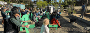
The group has organized a series of events including focus group meetings, “pop-up” events such as a Bike Tour of Skaggs Island, meetings with state, regional, and local agencies and community organizations over the past year. In November 2019, the Exploratorium held a recorded event with representatives from the State Coastal Conservancy, A. Philip Randolph Institute, South Bay Salt Pond, the Bay Area Conservation and Development Commission (BCDC), and others to discuss “Public Learning and Equitable Access During Climate Adaptation. You can listen to the event here.
Download Public Access Scoping ReportPhoto: Amy Hartman