
Mario Bañuelos
Back in the mid 1990s, I attended a week long course at the University of California Berkeley on a new and emerging technology. The course covered advanced tools used to create, maintain and analyze geographic information systems or GIS. Simply put, GIS may be characterized as a form of “smart maps” where geometric elements on a map are connected to data. A point can be symbolized as a restaurant, hotel, or any other feature and then linked to data like an address, phone number, etc. A line can represent real-time traffic conditions on a freeway that can be color coded to reflect different levels of congestion; red for very congested to green for free flow. An area can represent political party majorities during an election by displaying states in either red for Republicans or blue for Democrats. Or, as was the case in our class, areas could represent varying types of combustible material used to analyze the firestorm that ravaged the Oakland hills in 1991.
On the last day of instruction, the chair of the geographic department came and spoke to our class about the future of GIS. During his speech he said, “In the future, vehicles will be equipped with navigational equipment. If there is an accident along a route, the navigational equipment will alert the driver and the driver can take an alternative route avoiding the accident.” He shared with us other applications, many of which, over time, have become reality. Overall, his speech painted a bright and exciting future for GIS applications with unlimited possibilities.
During the question and answer session following his speech, I raised my hand and asked, “If in the future, all vehicles are equipped with navigational equipment that alerts drivers of incidents up ahead, wouldn’t such a warning system be ineffective if the number of alternative routes are limited?”
I mean, if a driver is stuck in traffic because of an accident, wouldn’t he be stuck trying to avoid it if everyone else was instructed to take the same alternative route? The question set off a classroom debate between the practical and the theoretical, between the ideal and real world. In the end, the department chair concluded that the only true solution was population control, which was way beyond the scope of our class work.
Today, we have mobile devices that provide real-time traffic information with re-routing options to avoid delays if an incident is reported. However, the problem of limited route options for drivers or commuters stuck in traffic still persists.
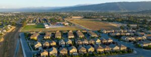
This past year, I attended a couple of workshops presented by the city of Morgan Hill to solicit community input on current and future projects that deal with alternative modes of transportation. One session that I attended was on the Santa Teresa Corridor extension, the north-south connection between Hale Avenue and Dewitt Avenue. City staff and a traffic consultant explained different traffic patterns based on various assumptions with different land-use scenarios.
The same was true when I attended the Monterey Road Improvement workshops that looked at the city’s long-term downtown specific plan, whose goals included creating a more pedestrian-friendly downtown. The question was raised for the redesign of Monterey Road between Main and Dunne avenues on whether to keep the current four-lane configuration, to reduce the lanes to two, or to combine both options.
Both of these projects, once built, will have an impact on the flow of traffic and will provide an alternative route for commuters traveling within or through South County.
What if, in addition to providing public input to city staff or consultants on projects, residents could browse to a website and make land-use decisions themselves, enter different growth options, and envision the future impact of those decisions? Thanks to an initiative by the Silicon Valley Community Foundation in collaboration with the Greenbelt Alliance, ordinary residents can do just that – they can participate on how the region is built and can provide feedback on future land-use patterns.
The website ‘You Choose Bay Area’ takes complicated planning concepts and translates them into user-friendly models that help residents understand in order to have a say in the development of their communities. Along with transportation, the site also examines population growth, our natural resources, public health and social equity. The educational, interactive website can be found at www.youchoosebayarea.org.
While certain technical advancements, like real-time navigational equipment, may have their limitations when applied to real world problems, new and emerging technologies can provide the tools not only for the public but for our government leaders to make sound decisions on the future development of the region and our communities. Technology can provide additional ways to get involved in one’s community.
Mario Banuelos has lived in Morgan Hill for 21 years. He has served on the south County Dayworker Committee and is a member of the Morgan Hill Community Foundation. He is married and has four children.
This article was originally published in the Morgan Hill Register.