By Richard Retecki and Carol Benfell, Published in Sonoma County Gazette
It’s taken the efforts of hundreds of people, organizations and government agencies, working together for more than sixty years, to preserve our magnificent, dynamic, and unique Sonoma County coast.
Now the Sonoma County Local Coastal Plan, an integral part of that decades-long preservation effort, is being revisited by county officials, and changes will be made. It will be important to be watchful and mindful that we do not lose what so many have fought to save.
Some of our coastal parks date back 90 years, to the very first days of the State Parks system—the 19-mile-long Sonoma Coast State Beach, one of the most visited state parks in California; Fort Ross Historic State Park, Kruse Rhododendron Reserve and Salt Point State Park.
In 1962, Doran Beach in Bodega Bay became the first county park to be created for public use. Gualala Point, Westside Park and Stillwater Cove followed Doran Beach as county coastal parks.
One of the biggest threats to the coast—and county residents—came when Pacific Gas & Electric in 1958 proposed a nuclear power plant at Bodega Head, right on top of the San Andreas Fault.
Bodega Bay residents fought back, led by Rose Gaffney and Hazel Mitchell, joined quickly by brothers Karl and Bill Kortum, and forestry student David Pesonen.
Their efforts launched a four-year-long public and legal battle, joined by The Sierra Club, The UC Marine Lab at Bodega Bay, and others. In 1962, PG&E reluctantly abandoned its plan.
At about the same time, plans were underway for massive housing developments along the coast. In the mid1960s, the Jenner Bay Corporation proposed a 1,100 acre, 2,000-home project, with condominiums at Goat Rock, a golf course at Shell Beach, and a shopping center and Safeway at the intersection of Highway 1 and Highway 116. A 3,600-acre large lot subdivision was slated for Willow Creek.
The potential loss of the coast to the public sparked a revolution. In 1972, after a massive statewide effort spearheaded by Sonoma County environmentalist Bill Kortum, voters approved Proposition 20, the California Coastal Initiative.
Enacted into law in 1976, the Act declared that the public should have access to the shoreline all along the California Coast. It also created the Coastal Commission and the Coastal Conservancy to administer and implement the Act.
It was a critical moment.
In the wake of the Act’s passage, intense negotiations between state and local governments with developers scaled back both the proposed Sea Ranch and Bodega Harbour residential developments from a combined total of 7,500 units to roughly 3,100 units. The Willow Creek subdivision was abandoned.
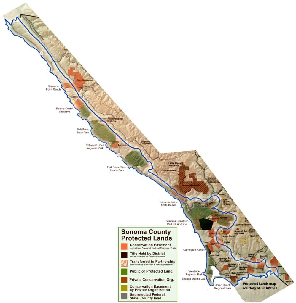
The Act led to incredibly successful partnerships between individuals, nonprofits and state and local agencies. As a result, thousands of acres of conservation easements, miles of coastal trail, and increased service facilities for public use and enjoyment have been acquired.
For example, two small grants to the Sonoma Land Trust (total $180,000) for analysis of acquisitions south and north of the Russian River from willing sellers, have secured properties and leveraged $75 million to $85 million for the acquisition of more than 25,000 acres along the coast.
Additional parks have been created. Some notable acquisitions are the Willow Creek State Park Addition (5,388 acres total); the Estero Preserve (127 acres); the Estero Ranch (578 acres); Carrington Ranch (345 acres); Collis conservation easements (1537 acres); Wright Hill Ranch (1355 acres); Jenner Headlands (5,630 acres); north coast Lorenzini Ranch, (137 acres); north coast Kashia Pomo Reserve (688 acres); and the north coast Stewarts Point Ranch (873 acres).
Along with acquisitions, vertical access ways such as Pinnacle and Short Tail Gulch have been built, park improvements have been implemented at Westside and Doran Beach county parks, and trail planning and construction are ongoing as part of the Bodega Bay Trails Plan. On the north coast, trails and camping improvements have been completed at Salt Point State Park.
These types of partnerships and transactions are also now commonplace throughout the entire county with the leadership of the Agricultural Preservation and Open Space District and our highly successful and effective nonprofit organizations.
Public involvement is also essential in tracking coastal plan permits and approvals, plan development and implementation and its local and cumulative impacts throughout the county coastal zone. The 1980 Local Coastal Plan had 95 people serving on nine citizen advisory committees and hundreds more were involved. The current Local Coastal Plan effort mirrors that.
Public input is also essential to produce the most thorough coastal plan, one that represents not only planning staff thoughts, but the inspection and responses of an engaged public.
Such steady commitment from all those involved should instill in all of us, a sense of love and caring for the unique and beautiful coastal zone. Those doing the work—volunteers, speakers at public hearings, staff members, nonprofit organizations, elected officials—insure a lasting legacy for our children and our grandchildren.
We are fortunate to live here, with this diverse and beautiful landscape. But to love the coast, we have to continue to save it.
The 1976 Coastal Plan allowed counties to make periodic updates to their local coastal plans and provided opportunity for public participation. Such an update is now underway here. Some of the changes being proposed will be critical to determining the fate of our coast and its resources for decades to come.
For more information go to: https://sonomacounty.ca.gov/PRMD/ Long-Range-Plans/Local-CoastalProgram/Public-Review-Draft/
What’s Next?
- Planning Commission Hearings (February-March)
- Board of Supervisors Hearings (Spring 2020)
- Coastal Commission Hearings (Summer 2020)
- Certification
Greenbelt Alliance’s Impact
Greenbelt Alliance used the Bay Area Greenprint to map and report on several key characteristics of the Sonoma Coastal Zone (SCZ) that need to be recognized and addressed in the Local Coastal Plan:
- 81% of the SCZ is in the Wildland-Urban Interface
- 46% of the SCZ is designated as Very High Fire Risk
- 78% of the SCZ is designated at Priority Lands for Conservation (Conservation Lands Network)
- 52% of the SCZ is designated at Critical Habitat Linkage
The Local Coastal Plan must ensure that these characteristics are addressed (in the case of wildfire risk) and protected (in the case of conservation and habitat) for the long-term.
For questions about the Sonoma County Local Coastal Plan, please contact Teri Shore, North Bay Regional Director.
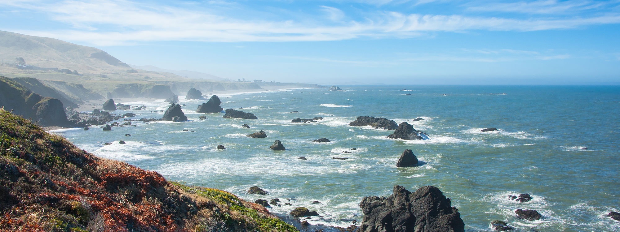
Photo: Harminder Dhesi via Flickr