
Thanks to all of you who joined our most recent webinar highlighting the role that greenbelts and smart growth played in the Kincade Fire. We learned so much from our guests, Town of Windsor Councilperson Deb Fudge and Deputy Fire Chief Matt Gustafson of the Sonoma County Fire Protection District. We don’t want you to miss any of this important content so we put together a summary of the conversation and even answered some bonus audience questions at the end. Watch a recording of the webinar below.
Webinar Q & A
Can you tell us a bit about the history of Windsor?
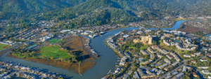
Deb: The Town of Windsor lies 60 miles north of San Francisco, between Santa Rosa and Healdsburg with a population of 28,000. In the 1980s Windsor experienced explosive growth, 1,000 homes a year were built between 1989 and 1990, and by 1992 Windsor was incorporated as a city. Our first general plan was drafted in 1995, with a growth management ordinance of 350 new homes built per year. The community felt that was still too much growth so in 1996 we had a new town council with an environmental majority who decided to create a growth ordinance of 150 homes a year (which still stands today). In 1998 we instituted a voter mandated Urban Growth Boundary and removed 300 acres from the original sphere of influence north of Arata, which means today we have 800 fewer homes than we would have. This area, which now includes a vineyard, is very important to the story of the Kincade Fire because we believe it helped to slow the fire from entering Windsor from the north.
Could you give us a quick overview of the Sonoma County Fire District?
Matt: The town of Windsor does not have a fire department, but the fire district has served the town for many years. We have gone through changes and consolidations because of the recent fires including establishing the Sonoma County Fire District in April 2019, which was born out of various districts that have served the region for over fifty years. We cover the area from Memorial Bridge in Healdsburg to the Graton Casino in Rohnert Park, and from Guerneville all the way to the Napa County line.
Please explain some of the differences between the Kincade Fire and the Tubbs Fire?
Matt: There were a tremendous amount of similarities and some differences between the two fires. Probably the biggest difference was that in Kincade there were absolutely no deaths, unlike the Tubbs fire where, unfortunately, 22 people lost their lives and we experienced roughly four to five times the amount of damage. The Tubbs Fire started outside of the county line and the Kincade Fire started inside of the county, giving us an earlier heads up and more time to prepare. Both fires started late in the fire season in October and were considered firestorms. The Kincade Fire was actually much larger than Tubbs, but much less destructive—burning up to the city lines of Healdsburg, Geyserville, and eventually down to the Windsor area.
Talk to us a bit about fire weather and what constitutes “red flag conditions”?
Matt: Over the last five to ten years we’ve taken fire weather extremely seriously and consider it an opportunity to staff up and get prepared. Red flag fire weather includes Diablo winds—winds out of the east that blows gusts of 25 mph or greater—relative humidity of 15% or less, and poor humidity recovery overnight. When we experience these weather conditions or red flag days, we take all of the necessary precautions to ramp up. One of the tools we have implemented after the Tubbs Fire was to put fire cameras up throughout Sonoma County to spot fires and give dispatchers the coordinates. It was one of these fire cameras that first spotted the Kincade Fire.
How and where did the Kincade Fire burn relative to Windosr’s greenbelts and developed areas?
Matt: When the fire started it was 16 miles away from Windsor and there were evacuation orders for Geyserville and North Healdsburg. Various indicators showed the fire was coming to Windsor and by Saturday morning we evacuated 28,000 people.
On Arata Lane at Highway 101 northeast of Windsor, the fire was easily more contained due to a pretty significant greenbelt area that included some grazing land and the vineyard that Deb mentioned, this allowed us to save homes in a nearby subdivision.
Another area where we were able to stop the fire was the Foothill Subdivision which backs up to Foothill Park. This park had heavy vegetation and had not experienced a fire for many years, making the firefight very difficult. We were able to stop the fire here because of the incredible amount of resources that we had both on the head of the fire and downstream. The big problem with these urban fires when we have gusts of wind over 25 mph are downstream embers which can cause new fires to take traction a mile or so away. The fire burned right up to and in between the homes at the Foothill Subdivision. There were greenbelts surrounding the neighborhood including a vineyard and a golf course. These areas helped slow the spread of the fire.
What factors allowed you to successfully stop the Kincade Fire?
Matt: There were many factors that allowed us to contain this fire. At the time there were no other large fires in California which allowed us to have an abundance of resources.
We had an engine stationed at every other driveway or every third driveway in the Foothill Subdivision area, this amount of resources is almost unheard of. We also had an effective evacuation–one of the biggest things we learned between Tubbs and Kincade was that we have to get people out early. We have improved evacuation technology which allowed us to get 28,000 people out of Windsor efficiently. The local knowledge that we possessed enabled us to set up a dozer division in the right places, including Foothill Park. The last thing I will mention were the natural buffers such as Hillview Vineyards and Chalk Hill Wineries which allowed us to slow the spread of the fire.
Can you talk more specifically about the role greenbelts play in firefighting?
Matt: We know that greenbelts coupled with the correct fuel management practices like prescribed burns and healthy groves, serve as buffers. Along with open space, this includes agricultural areas, vineyards, pastures, golf courses, and grazing lands. We are fortunate that in Windsor a majority of our urban growth interface has these buffers. For example, Chalk Hill Winery behind Windsor to the east burned less aggressively and with less ember cast. For typical fires (not mega-fires) these types of buffers are very helpful and almost always help us stop fires.
Audience Questions
You talked about the fact that greenbelts and agricultural land can slow regular fires, but do they provide buffers to mega fires?
Matt: Yes and no. With high, gusty wind fires, we are finding more downstream fires occurring. If you have a very large green buffer this can lessen the likelihood that an ember would land in a subdivision. An example of this was the Mayacamas Golf Course—the fire burned up to the golf course where it stopped and then took a different path. However, it is still possible that an ember could get picked up from a vineyard for example, and land in a subdivision on the other side of the land during an extreme wind event.
How much coordination is there between individual cities and the counties to coordinate land use planning and fire protection and prevention?
Deb: In Sonoma County, the cities worked together to establish our Urban Growth Boundaries (UGBs). Since the Tubbs Fire, cities and counties are working together even more closely, meeting regularly to talk about both planning and prevention.
Matt: In regard to the fire districts we now have one shared dispatch for the entire county and have consolidated agencies. However, fire marshals need to be included in planning meetings to discuss city UGBs and development. The Town of Windsor has always seen this as an advantage and has always included the fire district in their planning meetings.
Follow-up Q & A with Teri
How has increased fire risk altered existing development rules?
The Town of Windsor has adopted a stronger building code for the entire town (not in the highest wildfire risk areas) that is similar to the state standards in the high fire risk areas within the wildland-urban interface (WUI), which the town is calling the “warm WUI.” New state regulations for wildfire building codes risk went into effect statewide on January 1, 2020, and more are coming. Read more here.
Do you think UGBs surrounding entire cities and towns would be an important wildfire management tool?
The wildfire risk curve developed by fire science experts such as Alexandra Syphard have determined that the highest risk of loss of life and home to wildfire is in medium density housing located in the wildland-urban interface. Communities with Urban Growth Boundaries are far less at risk.
Are there any efforts to increase the fire resilience of the greenbelt buffers in a systematic manner?
Multiple firefighting professionals, fire ecologists, and non-profit organizations are working together to reduce wildfire risk in greenbelts and the wildland-urban interface through defensible space, prescribed burns, vegetation management and best forest management practices. There are multiple approaches and in some cases controversy. See what’s happening in Sonoma County.
Do you have resources you can point to for best practices in vegetation management?
Vegetation management for reducing wildfire risk is an evolving science. The new Sonoma Valley Wildlands Collaborative is developing environmentally sound practices for our region, which you can review here.
How have these fires impacted the local governments’ approach to planning policies?
Local jurisdictions take various approaches to reduce wildfire risk but all are required to adopt and implement Public Safety Elements in city and county General Plans that are at least as strong as state regulations. Local Hazard Mitigation Plans are also essential. But there is much more work to be done to ensure that firefighting professionals, planners, and the community coordinate to develop sound plans. Check out this website for recommendations on how we can do better.
For more questions on this topic, feel free to reach out to North Bay Regional Director, Teri Shore.
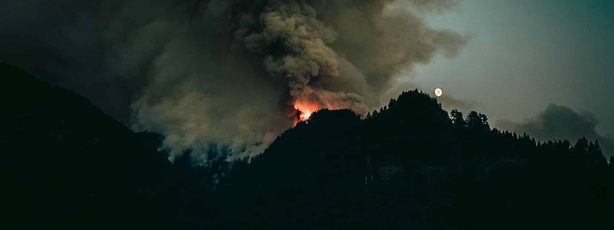
Photo: Luke Flynt via Unsplash