At Risk: The Bay Area Greenbelt 2012, is the Bay Area’s most trusted land conservation research.
The report finds that over 3 million acres of the region’s vital and stunning landscapes are protected. About one third of that is permanently preserved and two-thirds are protected by growth management measures. Yet more than 322,000 acres—the equivalent of 10 cities the size of San Francisco—remain at risk of development.
Also see At Risk 2017, At Risk 2006 and our At Risk 2012 Methodology
Executive Summary
We know we’re fortunate. The Bay Area’s open spaces provide fresh food, clean water, homes for wildlife, and places to play. Yet if the Bay Area is to remain one of the world’s most attractive places, we must not only fight against development in the wrong places but also invest in this landscape we treasure.
Safeguards work
It’s easy to look around at the Bay Area’s golden hills, farms, and parks and celebrate the progress we’ve made to protect our natural and agricultural lands. Conservation groups, by buying land or the rights to develop it, have brought the regional total of land permanently preserved to 1.1 million acres—out of about 4.5 million total acres. In addition, voters and leaders around the region have enacted a variety of growth management measures, protecting over 2 million more acres. Yet these rules are often tested, requiring vigilance to make sure they are not broken.
Bay Area Policy Protection Map
Risk still exists
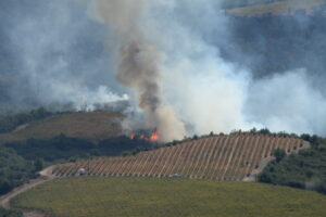
Even with many safeguards in place, sprawl still threatens to shrink the greenbelt. More than 322,000 acres—the equivalent of 10 cities the size of San Francisco—remain at risk of development. Compared to our At Risk 2006 report, major advances in open space protection and a six-year sluggish real estate market reduced the amount of land at high and medium risk of development by 20%. But as the market heats up again, development threats will dramatically increase.
Bay Area Lands At Risk Map
Fund what we value
Protecting the land, however, is only a first step. Even lands not at risk of sprawl development can be threatened in other ways. Agricultural land can lie fallow if farmers can’t make a living; habitats can succumb to invasive species if they are not properly stewarded; parks can close without sufficient funding. We must properly invest in our landscape so that it is nurtured for years ahead. The region’s quality of life and economic health depends on a greenbelt of agricultural land, wildlife habitats, watersheds, and parks.
Vital lands identified
Everyone—from environmentalists to farmers to business owners—has an interest in seeing the Bay Area thrive. At Risk: The Bay Area Greenbelt 2012 identifies where to take action.
Results by County
[tabs] [tab title=”Alameda”]Alameda County, with its urban side and rural eastern side, has a long record of positive conservation efforts, including protecting scenic East Bay hills and ridgelines and creating much-loved parks. The East Bay Regional Parks District includes more than 112,000 acres of public land in Alameda and Contra Costa counties—a total of 65 parks including over 1,200 miles of trails. The district is a national leader in acquiring lands and making them publicly accessible for hiking, biking, and other outdoor activities.
Of the land that is neither permanently protected nor already developed, 87% is protected by policy measures. The vast majority of that land enjoys high protection, thanks in large part to Measure D, the Save Agriculture and Open Space Lands Initiative. Passed by voters in 2000, Measure D requires voter approval to increase development capacity on county land and requires cities to abide by the urban growth boundary in the eastern part of the county.
Despite strong policy protections on much of Alameda County’s land, some 30,000 acres remain at risk of development. Doolan Canyon, the area between Dublin and Livermore, remains ground zero for ongoing land-use battles, including a controversial proposal to develop as many as 1,990 units of sprawl housing.
Alameda County Policy Protection Map
The area east of San Ramon, including the Tassajara Valley, is protected by urban growth boundaries that prevent the jurisdictions of San Ramon, Danville, and the county from expanding eastward.
In 2010 the San Ramon City Council attempted to expand its growth boundary, allowing sprawl development across 1,579 acres. Councilmember Phil O’Loane co-led a successful effort by residents to stop the expansion, convincing 71% of voters to oppose the city’s measure.
However, the threat of sprawl in the Tassajara Valley still looms large. Developers regularly push the county to approve a major developments outside the growth boundaries. Approval of this sort of development would eviscerate the integrity of the growth boundary and put open space lands across the county at risk of similar attacks.
San Ramon’s decisions to maintain their boundaries are a model for other communities in Contra Costa County. For example, large swaths of the eastern county have been deemed fair game for development in Pittsburg, Antioch, Brentwood, and Oakley. Contra Costa County has the most acres at high risk of development of any county in the region—over 18,000. More action is necessary to preserve the hills, valleys, and rich farmland to help protect this land for future generations.
Contra Costa County Policy Protection Map
Contra Costa County Lands At Risk Map[/tab] [tab title=”Marin”]Marin is home to national, state, and county parks, protecting 80% of county land. The Marin Agricultural Land Trust maintains conservation easements of more than 44,100 acres on 68 family farms and ranches. Even so, Marin’s hillsides are still vulnerable to the construction of “McMansions.”
But just because there shouldn’t be more houses in the hills doesn’t mean there shouldn’t be development in Marin County. The lack of home choices has made Marin the regional leader in in-commuters, with 60% of its workforce driving in from other counties. To give employees the chance to live locally, new development needs to be near 101 and future Sonoma-Marin Area Rail Transit stations. The county’s largest challenge is to communicate to residents the benefits more homes will have on the environment and the economy.
Marin County Policy Protection Map
Measure J, approved in 1990, was Napa County’s landmark agricultural initiative that helped nurture its wine industry. It requires a two-thirds vote of county residents before agricultural land can be developed for anything other than agricultural uses.
In 2008, the measure was renewed as Measure P, protecting the county’s rural character for another 50 years. As a result of this long history of protection, Napa County has the lowest level of at risk land in the region, with only 1% of its acreage at risk of development. But there is still concern about park closures, the loss of public land, and the growth of rural estates. Agricultural land in Napa County, unfortunately, is often sold into 100 to 200 acre parcels for large estate homes. While growth at this scale may not seem significant, rural development that breaks up landscapes—for example, with fences around private lots—prevents wildlife migration and makes food production unrealistic.
Napa County Policy Protection Map
San Mateo County is a leader in open space protection, both through direct purchase of land and through policy protection. The county is fortunate to have both the Mid-Peninsula Regional Open Space District and the Peninsula Open Space Trust. Together, these organizations permanently protected an additional 2,500 acres since 2006. San Mateo is second only to Marin County in the percentage of its landscape that is permanently protected: 38% of total acres.
San Mateo County’s urban/rural boundary is a unique policy approach that limits the intensity of development based on a series of criteria, including how steep the hillside is and the quality of the soil. The complex formula can still allow some land outside the boundary to urbanize; this leaves much of the county under only medium protection. Nonetheless, San Mateo has a relatively low level of land at risk of suburban sprawl (only 6%) because most land outside the boundary has steep slopes and is difficult to develop. Much of the threat to open space in the county is primarily from rural estate homes on large, undeveloped parcels of land.
San Mateo County Policy Protection Map
Santa Clara County was once known as the “Valley of Heart’s Delight” for its abundant fresh food.
Since then, company after company sprang up in Silicon Valley—paving over acres of agricultural land—making protection of the region’s remaining farmland essential. Coyote Valley is one such area that historically has been continuously at risk of development. But thankfully, San Jose’s adopted General Plan puts development of much of Coyote Valley off the table through 2040. Other historic threats from the past—such as development proposals in Sargent Ranch south of Gilroy—have also eased in recent years.
Many threats remain in Santa Clara County; over 63,400 acres of land are still at risk. Gilroy is an attractive area for sprawl development. Gilroy’s intent to move its future high speed rail station out of downtown and onto prime agricultural land poses a significant risk, as does rural parcelization of agricultural land in San Martin south of Morgan Hill.
Fortunately, more people are working to sustain and enhance the county’s agricultural heritage in both the greenbelt as well as urban farms in cities. For example, Veggielution, a 2-acre nonprofit community farm, grew 22,000 pounds of food in 2011 and educates hundreds of people about organic gardening each year. The county has begun a Food Systems Alliance to focus on improving access to healthy food and helping local agriculture become more viable.
These exciting developments, combined with a renewed focus on infill development by San Jose, the region’s largest city, mean Santa Clara County residents may finally be able to enjoy the benefits of both Silicon Valley and the Valley of Heart’s Delight.
Santa Clara County Policy Protection Map
There has been a lot of change in Solano County, including some poorly planned growth. Solano’s Orderly Growth Initiative, originally approved in 1984 and renewed by voters in 2008, protects agricultural land and is the primary reason Solano has its beautiful open space between cities.
The renewal of the initiative passed with nearly 70% of the vote. The Orderly Growth Initiative is one component of ensuring 73% of Solano’s greenbelt lands enjoy a high level of protection.
Yet over 30,800 acres remain at high and medium risk of development in the county. The Dixon Ridge area outside the city is some of the Bay Area’s best farmland. Dixon—located along the I-80 corridor within easy commuting distance of Sacramento—lacks an urban growth boundary, leaving adjacent agricultural land vulnerable to sprawl.
Solano County is expanding opportunities for agri-tourism as a way to generate revenue. The only county in the Bay Area without an Open Space District, Solano could add one to help protect its natural areas as well as promote its agricultural heritage.
Solano County Policy Protection Map
The next decade will be important for Sonoma County. While it can proudly boast urban growth boundaries around each of its nine cities, the county lands remain open. Rural residential development of these properties continues to pose the single largest threat to preserving productive farm and ranch land, and disrupts contiguous wildlife habitat. Over 250,000 acres of Sonoma County’s greenbelt remains minimally protected; another nearly 500,000 acres have only medium protection. Innovative growth management measures may be necessary to protect these vital lands.
Protecting the landscape is important to Sonoma County residents; in 2006, 76% of voters supported reauthorizing the Sonoma County Agricultural Preservation and Open Space District for another 20 years with a 0.25-cent sales tax. Smart land management practices combined with the permanent protection work of the Sonoma Land Trust and others will benefit wildlife and residents.