
The “rainy” season in the Bay Area is nearly finished, and we’ve had very little rainfall. That means that most of the region, and the entire Golden State, is back in a drought—among the top 10 driest years. San Francisco’s rainy season alone is ranking as seventh driest in more than a century.
Some experts wonder if California’s wildfire season will start even earlier given that 85% of the state is in a drought. New research certainly points to this with decreases in precipitation and delays in the rainy season amplifying wildfire risk.
At the center of California conversations about wildfire risk are three simple letters: WUI. They stand for Wildland-Urban Interface.
What Exactly is the Wildland-Urban Interface?
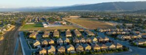
Imagine an area of land where houses (the built environment) meet wildland vegetation (the natural environment), and you have yourself a WUI. This combination also creates a unique situation that allows for the ignition and spread of wildfire. WUI growth often results in more wildfire ignitions, putting more lives and houses at risk. In short, WUI areas are where wildfire problems are more pronounced.
Looking like a simple acronym, a WUI area can, in fact, take different shapes and forms:
- Development that is scattered throughout the wildland vegetation, which is often found in rural or large-lot suburban developments (practitioners call this Intermix WUI).
- Development that is grouped near areas with wildland “fuels” or vegetation, with a clear line separating the development and vegetation. For example, think of development bordering public lands or when an urban growth boundary is in place (practitioners call this Interface WUI).
- You could also imagine a more urban environment right up against an island of wildland fuels, like a community park, open space, greenbelt, or other natural areas. For more WUI basics, view this report by the American Planning Association.
Every single state in the U.S. has a WUI where one-third of all U.S. homes are built.
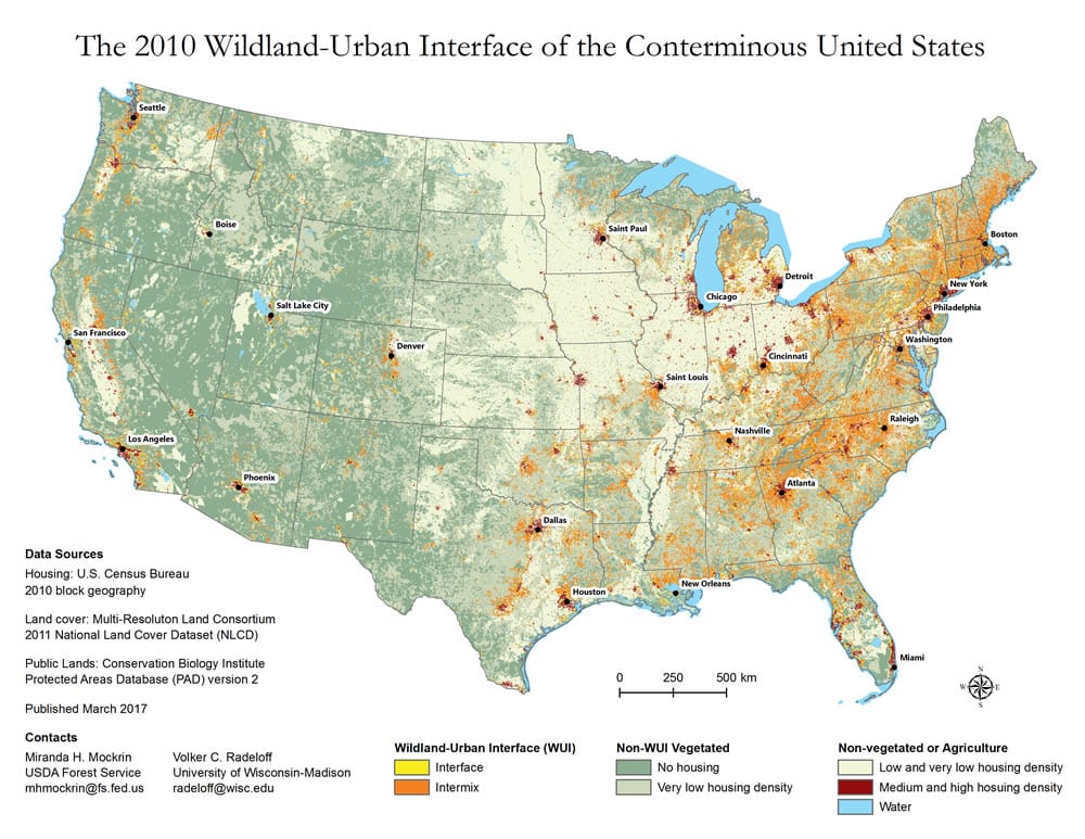
California has the most people living in the WUI, or 32% of all housing units. This means 11 million people in our state are living in a wildland-urban interface area. Compared to all other U.S. states, California’s annual property loss and damage from fires within the WUI is frequently above anywhere else.
Why is the WUI Important?
Regardless of the type of WUI, wildfire risks are highest in these areas. Of any land-use type in the U.S., WUI areas experience the most wildfire destruction. That’s because the WUI has a set of conditions that can allow a wildfire to spread through development.
How severe are wildfire impacts in a WUI area? That is where things get complex, and must be seen as a dynamic set of conditions and not a static state.
Severity of wildfire impacts depends on a range of factors. Where are the homes, businesses and infrastructure placed? How clustered together (dense) are they? How are the structures built (materials used)? What is the kind of vegetation, how much is there, and how is it arranged in relation to the structures? What are the local weather conditions and the topography (factors like slope, terrain, and elevation)?
For example, the vegetation could be flammable and the materials used to build the homes could be combustible. These are just a few of the range of conditions that contribute to how structures ignite and burn during a wildfire event in the WUI. Above all, research has shown that the location and arrangement of homes in fire-prone landscapes such as the WUI is the highest risk factor for loss of life and home, above all the others.
Land-Use Planning is Key to Reducing Damages and Losses in the WUI
Planning where and how new development is built, and what requirements are in place to reduce risk of existing development currently in the WUI, will influence how vulnerable current and future communities are to wildfire.
In the wake of incredible losses and the record-breaking wildfire season California had in 2020, our state must urgently do more to keep communities safe from wildfires while also addressing the acute housing crisis to ensure the housing needs of all Californians are met.
In a new report by the Community Wildfire Planning Center (CWPC) analyzing land-use policies in fire-prone states, compared to our neighbors, California has a foundation of state-level policies and regulations for how local jurisdictions address wildfire that other states just don’t have yet. Which is good news. And, still, that gets us only some of the way to reducing risks from wildfires in the Golden State.
These include California’s 2008 building code requirements for the WUI and Fire Safe Regulations for rebuilding or new development post-1991. In the Camp Fire in Paradise, studies show 51% of the 350 houses built after the landmark 2008 building code escaped damage. In contrast, only 18% of the 12,100 homes built before 2008 escaped damage.
More work is needed to reduce the risk of existing buildings in high fire risk areas, which the State can lead on while ensuring that homes for low- and moderate-income households in these locations are retrofitted to be fire safe.
More Understanding and Attention is Needed on the WUI
Paying more attention to the WUI is needed in land-use planning for California and other western communities facing wildfire disasters and population growth pressures.
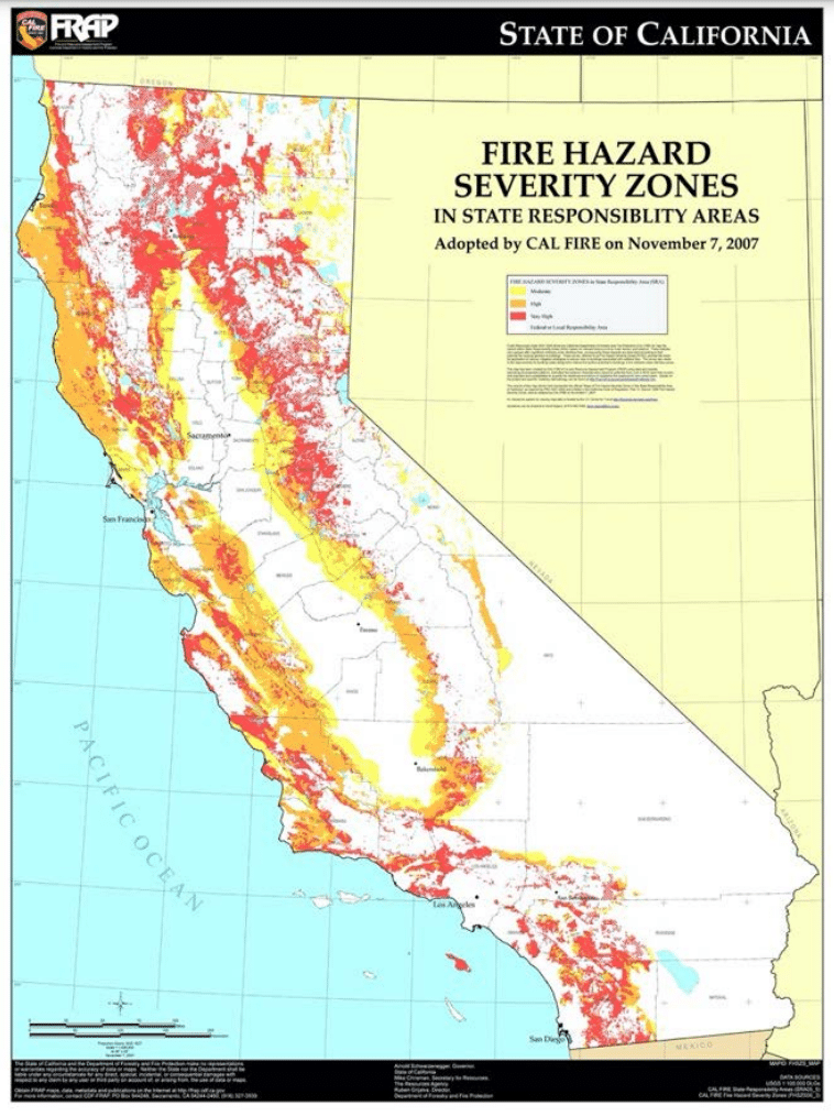
To start, California needs to update its statewide assessment of fire hazard severity zones, which currently is outdated. Doing so is a start at better understanding the different levels of wildfire risk in the WUI. This is critical to fully inform how we plan for future growth taking into account climate impacts.
When considering the different levels of risk, more attention is needed on land-use planning where there could be opportunities to place more housing in low- to moderate-risk areas with fire-resilient codes and requirements for such new developments coupled with design principles that include nature-based tools like irrigated agriculture and actively managed open space to bolster resilience to wildfire.
This quote from the CWPC report sums up the mindset shifts and collective nature of our efforts required to successfully move forward:
“Reducing the threat of hazards must move beyond either/or discussions (e.g., investments in fuel management or home hardening) and instead acknowledge that land managers, elected officials, policymakers, first responders, land-use planners, developers, and residents all play a role in wildfire solutions.”
Report author and expert WUI land-use planner Molly Mowery reflects on her work to date with others including Greenbelt Alliance:
“Implementing meaningful land-use planning solutions to address our WUI challenges takes time, commitment, and collaboration, but with great partnerships and a multi-disciplinary approach, I’m confident we are making progress.”
So let’s keep talking about the WUI. Together, we have an opportunity for better collaboration and innovative ideas on land-use planning decisions in the WUI to address wildfire risks to current and future communities while supporting the growth that California needs to meet its housing goals.
Visit this link to read the full analysis, Land Use Planning Approaches in the Wildland-Urban Interface: An analysis of four western states: California, Colorado, Montana, and Washington, prepared by Community Wildfire Planning Center, February 2021.
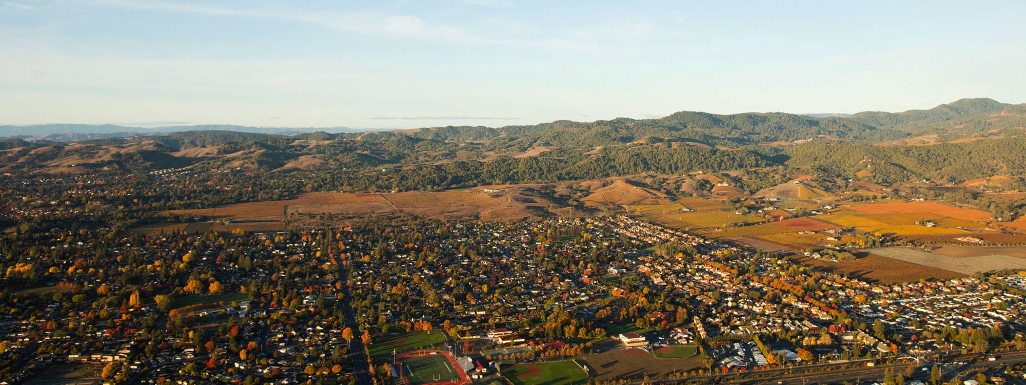
Photo: WineCountry Media via Flickr