
The author Meghan Hart was a UC Berkeley Goldman School of Public Policy (GSPP) Fellow and Greenbelt Alliance research collaborator between February and May 2026.
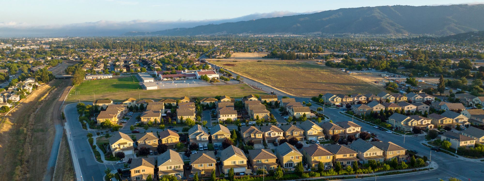
For decades, California has been building new homes in the wrong places. Between 1990 and 2020, nearly half of new housing development landed in the Wildland Urban Interface (WUI), where suburbs intermingle with fire-prone vegetation.
State legislators and advocates are aware that building in WUI areas is increasingly problematic, threatening both natural habitats and our ability to meet our climate goals. The stakes have not been higher, but there are significant challenges—both structural and political—to redirecting new homes away from urban fringes and towards existing communities.
Governance Challenges in Land-Use Planning
Land use planning is very decentralized. No one group, agency, or even layer of government is the primary driver of where to build in California. Each jurisdiction has its own rules and perspectives on what to build. Individual projects on the edge of town may seem to have a small impact, but in aggregate, this pattern of development takes a toll on natural habitats, air quality, and the health of our communities. Experts call these “spillover” effects, or the unintended costs of one person’s decision falling on others, who never had a say in the decision-making.
Spillover effects are a signal that we need state-level intervention. In the past 10 years, lawmakers have passed legislation aimed at guiding development to reduce these effects by making it easier to build within existing communities. Recent successes include our co-sponsored Senate Bill 79, making it easier to build near transit, and strengthened support for Accessory Dwelling Units (ADUs)
Nevertheless, there’s a long way to go to make up for the sprawling development of the last 80 years.
Current Tools Fall Short

So, what state policies best meet the moment? To date, few tools exist to help advocacy organizations identify which legislative solutions have the greatest impact and move us closer to thriving, walkable communities. Without a research-based framework for evaluating novel policy ideas, it’s difficult to know where to focus advocacy energy.
Existing tools each capture part of the problem, but very few connect the need to protect habitats with the imperative to build in existing cities. The Terner Center’s Housing Development Calculator captures market forces well, but it is not intended to project statewide and doesn’t account for the impact of development on ecologically valuable lands. Conservation tools display environmentally sensitive areas, but don’t incorporate housing demand or the planning decisions that put those areas at risk. This gap exists for a good reason—it’s difficult to predict the long-term impact of a housing policy on production, since development is so dependent on interconnected market factors. Tracing how a policy might indirectly affect habitats and ecological processes is even harder to measure.
A New Framework
To work around the tradeoffs in measurement, I spent this spring as a fellow investigating how state land-use policies shape development patterns and using those findings to design an evaluation framework that captures both conservation and housing development dynamics. My research culminated in 5 main findings, which became the basis for the tool:
- Location-based housing policies offer many benefits for residents, including boosting new housing development in existing communities and away from ecologically significant and sensitive habitats.
- Although the state legislature has made progress, many barriers to compact development remain. The main challenges include political opposition at the local level, financial barriers, high costs of construction, and land readiness.
- Policies that split responsibilities across departments or require complex administrative processes increase a policy’s risk of failing to deliver on its intended outcome.
- Economic levers—like taxes or subsidies—that rebalance the relative attractiveness of building in cities compared to urban fringes can benefit residents, but need to be carefully evaluated for which groups bear the costs.
- Some of the most effective state policies are those that offer the clearest expectations and provide defined, predictable guidelines for local governments to implement.
I used these findings to build the evaluation framework, which works in three parts:
First, we ask whether a policy idea is location-based. For policies that apply to specific places, we use an ecological risk map to assess whether the policies might impact sensitive areas, like valuable farmland, critical habitats, and areas at risk of wildfire.
In the second stage, we ask what outcome a policy is trying to achieve and how the design and implementation can help or hurt that goal. Based on the available details, we can estimate relatively how much land would be impacted and how significant the barrier to infill housing. Then, using a few more questions, we can estimate how likely the policy is to achieve its goal. Combining the magnitude and likelihood produces a rough internal ranking that surfaces tradeoffs more intuitively than looking at either input on its own.
Finally, the framework collects practical considerations, including estimating the likely time to impact, noting the political environment, and capturing any current events the organization is aware of that may aid in decision-making. As a result, the framework produces a policy profile that brings more rigor to the organization’s legislative strategy.
The Big Picture
Land use decisions are hard to undo. This tool will help Greenbelt Alliance identify policies that move California closer to actually producing vibrant, connected communities and protecting the invaluable land we all enjoy. It gives the organization a shared language for discussing the tradeoffs and making the case to coalition members. Using the insights from the framework, the organization can push for policies that move California away from the fire-prone, fringe development of the last few decades, and towards the connected, sustainable communities that we know benefit both people and the environment.
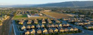
Header Photo: Gilroy aerial view. By Karl Nielsen/Greenbelt Alliance